News Desk
SYDNEY: Several bushfires burning across Australia’s east coast could further worsen as a severe heatwave caused temperatures to rise in several regions of the country, including Sydney, fire authorities have warned.
A total of 33 fires are burning across New South Wales (NSW), most populous state in Australia, with 12 still not contained. Five public schools have been closed amid a total fire ban across large parts of the state. Strong winds caused the fires to spread rapidly, the NSW Rural Fire Service said.
A blaze 250 kilometers (155 miles) north-west of Sydney triggered first emergency fire warning in the region in two years.
Firefighters said they were battling 10-15m (49ft) high flames.
Residents in affected areas across NSW have been urged to evacuate, and there are reports of damage to some properties.
Some parts of the state also reported temperatures above 40C (104F) on Monday, for the first time since January 2021.
Australia’s Bureau of Meteorology
Australia’s Bureau of Meteorology (Bom) has warned of occurrence of dry thunderstorms across eastern NSW, which could cause new fires.
The hot and dry conditions are expected to persist till Wednesday.
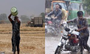
Eastern Australia has experienced three consecutive summer seasons of La Niña conditions, with above-average rainfall which caused widespread flooding. Last year was Sydney’s wettest since records began.
Start of the El Niño phenomenon
But the Bom said last week that its models suggested La Niña was likely about to end, with a return to neutral conditions or even the hot and dry El Niño phenomenon expected in autumn.
La Niña and El Niño are the climate patterns in the Pacific Ocean that can affect weather globally. Episodes of El Niño and La Niña typically last 9-12 months, but can sometimes last for years. El Niño and La Niña events occur every 2-7 years, on average, but they don’t occur on a regular basis. Generally, El Niño occurs more frequently than La Niña.
El Niño: El Niño means Little Boy in Spanish. During El Niño, trade winds weaken. Warm water is pushed back east, toward the west coast of the Americas. South American fishermen first noticed the periods of unusually warm water in the Pacific Ocean in the 1600s. The full name they used was El Niño de Navidad, because El Niño typically peaks around December. El Niño can affect weather significantly. The warmer waters cause the Pacific jet stream to move south of its neutral position. With this shift, areas in Canada and the northern US are warmer and dryer than usual. But in the US Gulf Coast and Southeast, these periods are wetter than usual and have increased flooding.

La Niña: La Niña means Little Girl in Spanish. La Niña is also sometimes called El Viejo, anti-El Niño, or simply “a cold event.” La Niña has the effect opposite to El Niño. La Niña causes the jet stream to move northward and to weaken over the eastern Pacific. During La Niña winters, the South sees drier and warmer conditions than usual. Canada and the North tend to be wetter and colder.

At least 33 people and an estimated three billion animals and birds died in 2019-20 Black Summer fires, one of Australia’s worst-ever natural disasters.